Get your maps here!
The RCDR map is for sale in the Visitor Center for $5. If you need to plan a trip before you visit, or prefer to use our online resources, we’ve also added interactive and downloadable maps below:
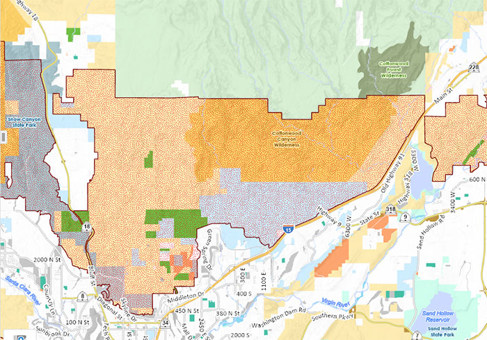
Interactive Map
Use our interactive map. Search for trails and trailheads. Learn important information.
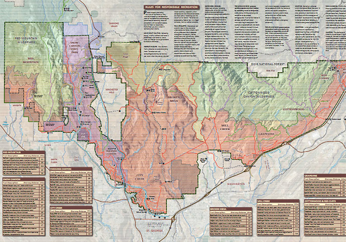
Brochure & Map
View and/or Download PDF version of our Brochure and Map.
Personal Safety
Hiking or riding in the Red Cliffs Desert Reserve provides a wide range of experiences suited for a variety of users. Trails vary from easy to extremely strenuous and involve significant challenges when adequate preparation is not made. Extreme heat in the summer, cold temperatures in the winter, lack of shade or water, sudden downpours, lightning, flash floods, deep sandy soils, rocky inclines, steep drop-offs, wild animal encounters, and unapproved user trails all create potential challenges that require planning and preparation. Users are urged to use good judgment and honest evaluation of capabilities when choosing activities in the Reserve.
Visitors are strongly encouraged to wear clothing (including footwear) appropriate for the trails they intend to explore, carry sufficient water, sunscreen, and repellent to meet their basic needs, and to obtain sufficient information from agencies, user groups, maps, and existing literature to understand the nature of the environments they are likely to encounter and precautions that need to be made. For back-country hiking in remote canyons and other areas, it is critically important to leave word with friends or family when and where you intend to hike. Search and rescue operations cannot be fully implemented if teams don’t know where to begin looking for you if you are lost or injured. Cell phone coverage does not exist in most canyons and remote sections of the Reserve. For your own safety, hiking or riding in these areas should always include two or more persons. Topographic maps, GPS units, and emergency supplies are highly recommended for all such excursions. For more information, you may contact the Red Cliffs Desert Reserve at 435-301-7430, the Bureau of Land Management at 435-688-3200 BLM Recreation Website, or Snow Canyon State Park at 435-628-2255 SCSP Website.
Take Area Maps
A take area is a geographical area outside the Red Cliffs Desert Reserve designated as Mojave Desert tortoise habitat. Click here for maps and details.