Lange’s Dugway
The Lange’s Dugway trail is most often accessed from its south end starting at the Black Gulch trailhead parking area off the Cottonwood Road. A stepover gate across the road serves as an entry point where visitors proceed down a dugway (road or way cut out of a hillside) to the bottom of Black Gulch and then up the rock-walled dugway for ¼ mile till reaching the mesa top. The two-track trail is suitable for hikers and equestrians. However, sections with sharp lava rocks make it challenging for some bikers. The trail originally served as the pioneer wagon route from St. George to the outlying community of Veyo but now serves partly as access for emergency vehicles and powerline maintenance trucks in addition to recreation use. About 2½ miles up the trail, the connection is made to the easy Alger Hollow trail (which proceeds 2.1 miles to the Lava Ridge trailhead). Lange’s Dugway trail continues another 2 miles till it terminates at the boundary of the Red Cliffs Desert Reserve. From this point on, a faint, narrow trail continues about 1 mile to the north on private property till it reaches a gate on a public road in south-central Diamond Valley. Overall, Lange’s Dugway is an easy to moderately difficult trail with an elevation gain of 520 feet to the highest point and a total up and down elevation change of 1160 feet. The trail runs through areas of desert scrub brush, grasses, and patches of Utah juniper with floral displays in wet years. Views from the top of the mesa include portions of St. George and the surrounding community, upper Snow Canyon, the southern mountains into Arizona, and occasional glimpses of the Pine Valley Mountains. The trail runs entirely across public lands administered by BLM within the Red Cliffs NCA.
-
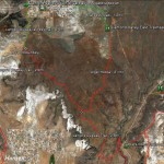
- This map shows the Lange’s Dugway trail along with key linkages to adjoining trails.
-
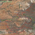
- This map shows the relationship of Lange’s Dugway trail to all other trails in the extended area.
-
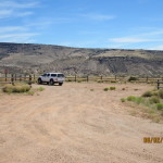
- Most visitors will use the Black Gulch trailhead to park their vehicles across the street from the trail’s entry point.
-
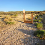
- Visitors enter the Lange’s Dugway trail through this stepover on the south side of the Cottonwood Road.
-
- The trail begins by dropping down-slope through this dugway after crossing the stepover.
-
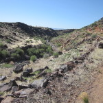
- While dropping down into the Black Gulch drainage, visitors will observe Lange’s Dugway climbing across the Black Lava formations above the wash.
-
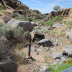
- At the bottom of the drainage the trail passes by the entrance to the Black Gulch trail which runs along the bottom of the wash.
-
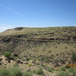
- From the junction with the Black Gulch trail, Lange’s Dugway proceeds up-slope on the western side of the drainage.
-
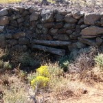
- Along the trail visitors will observe some of the craftsmanship of the pioneers who built the dugway and other improvements in this very rugged environment.
-
- Well up the trail, visitors will observe the old wagon road that served pioneers back into the late 1800’s.
-
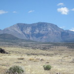
- Along middle portions of the trail, visitors will have excellent views of the beautiful Pine Valley Mountains to the north.
-
- Approximately 2.5 miles from the start of the trail, visitors will encounter this junction with the Alger Hollow trail which proceeds up to the north.
-
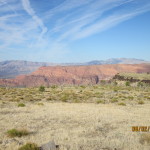
- From the eastern portion of the trail, visitors will get occasional glimpses of the red rock formations in Snow Canyon State Park.
-
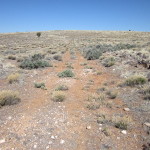
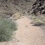
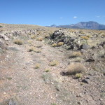
- The west end consists primarily of a rocky two-track trail.
-
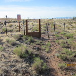
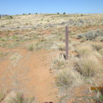
- The official trail ends at this stepover at the boundary of the Red Cliffs NCA and private lands on the west.
-
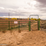
- Visitors may continue from the west end stepover on a user trail that ends at this privately owned entry point in Diamond Valley. Please respect private property.