Red Mountain
The Red Mountain Trail is located primarily in the Red Mountain Wilderness Area and extends from the Red Mountain trailhead off Highway 18 above Diamond Valley on the north to the Ivins trailhead at the top of 200 East in Ivins on the south. The trail from the Highway 18 trailhead is about 9.5 miles long with an initial elevation gain of about 400 feet to its high point and total up and down elevation change of more than 2,000 feet at the base of Red Mountain, including a 1500 foot drop in the last quarter mile. The trail to the West Canyon overlook and beyond is an old 2-track route that varies from extremely rocky (especially the first mile) to sandy. The 2-track trail continues over Red Mountain for a total of about 6 miles from the trailhead before it fades away. There is no official trail for the last couple of miles to the mountain’s southern end or to the top end of the Gunsight route. Off trail hiking is allowed in this “upland zone” and many hikers and equestrians choose to take the more scenic “alternate” route closer to the rim that would include the beautiful, white-rocks area rather than following the old 2-track route. There are no trail signs after the Snow Canyon Overlook trail junction sign (which is frequently down or missing). A good topographical map and/or GPS will be helpful, if not essential, but getting disoriented is still a possibility in areas with no official trail, no signs, and numerous user tracks that often lead to nowhere. Lost hiker rescues are not uncommon in this area due to lack of preparation and proper orientation. In addition to the Red Mountain route that descends to the toe of the mountain above Ivins, the descent may also be done via the Gunsight route. Both descents are extremely steep and rocky with an elevation loss of about 1500 feet. Neither route is marked with signing until you have reached level land near the respective trailheads. A shuttle vehicle would be required to return to the Red Mountain trailhead. No vehicles, including bikes are allowed in the wilderness area.
A very popular hike is from the Red Mountain trailhead to the spectacular Snow Canyon and West Canyon overlooks and back. The elevation gain is about 400 feet with a total up and down elevation change one-way of about 550 feet. Great views exist of the canyons and beyond. Visitors will travel 1.8 miles to reach the turnoff to the Snow Canyon overlook. A trail sign (or a large user-built cairn) directs visitors to a side trail of about 0.5 mile length that takes you directly to the overlook. Total one-way distance to the West Canyon overlook is 2.5 miles.
Another exceptional attraction is the “white-rocks” area that can be seen at a distance from the West Canyon overlook. It is about 1.5 miles past the West Canyon overlook with an additional elevation change of about 200 feet (100 down, 100 up). There are no official trails in this area and one of several routes must be discovered to reach this multicolored, sandstone, and Ponderosa area. Hiking to the West Canyon overlook or white-rocks area and back to the Red Mountain trailhead would be of moderate to strenuous difficulty.
Shorter hikes from the Ivins trailhead and the Gunsight trailhead off Tuacahn Drive to the top of the southern end of Red Mountain are frequently made by hikers and various groups which entail a brutal, uphill climb of 1500 feet along unmarked routes and loose rocks. Neither route is suitable for equestrians. See the specific description of the Gunsight route. Both routes are extremely strenuous and should be taken only by persons in good physical condition. Views from the top include all of central Washington County, Zion National Park, and portions of Arizona and Nevada.
Hiking the complete trail from Highway 18 and descending via the Red Mountain face or Gunsight route is an exceptionally strenuous hike and would not be recommended for anyone without back-country and off-trail hiking experience or without a knowledgeable guide. Except for a short segment at the southern-most end, the trail crosses lands administered by the BLM within the Red Cliffs National Conservation Area. Portions of the face of Red Mountain at the south end of the trail are located on lands administered by the Utah Division of Parks and Recreation.
-
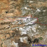
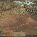
- Red Mountain Trail Map
-
- This map shows popular overlooks reached from the Red Mountain trailhead off SR-18.
-
- The Red Mountain Trailhead is 2 1/2 miles North of the turnoff to Diamond Valley on highway 18. A small sign at the highway intersection shows the entry point to the trailhead.
-
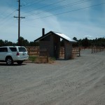
- The Red Mountain trailhead accommodates hikers and large numbers of equestrians.
-
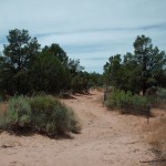
- The trail leaves the trailhead as a sandy 2-track fenced on both sides to acomodate ATV’s to the wilderness boundary.
-
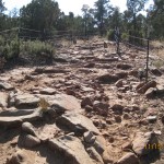
- The trail quickly turns into a rocky 2-track that requires caution by hikers and equestrians.
-
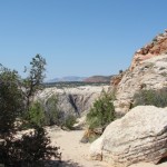
- The Snow Canyon overlook site offers a natural resting area as well as great views.
-
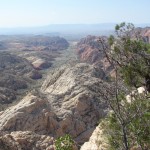
- View from the Snow canyon overlook.
-
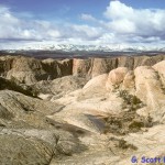
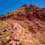
- Spectacular view of White Rocks area.
-
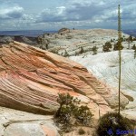
- Sandstone formations in White Rocks area.
-
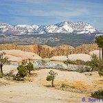
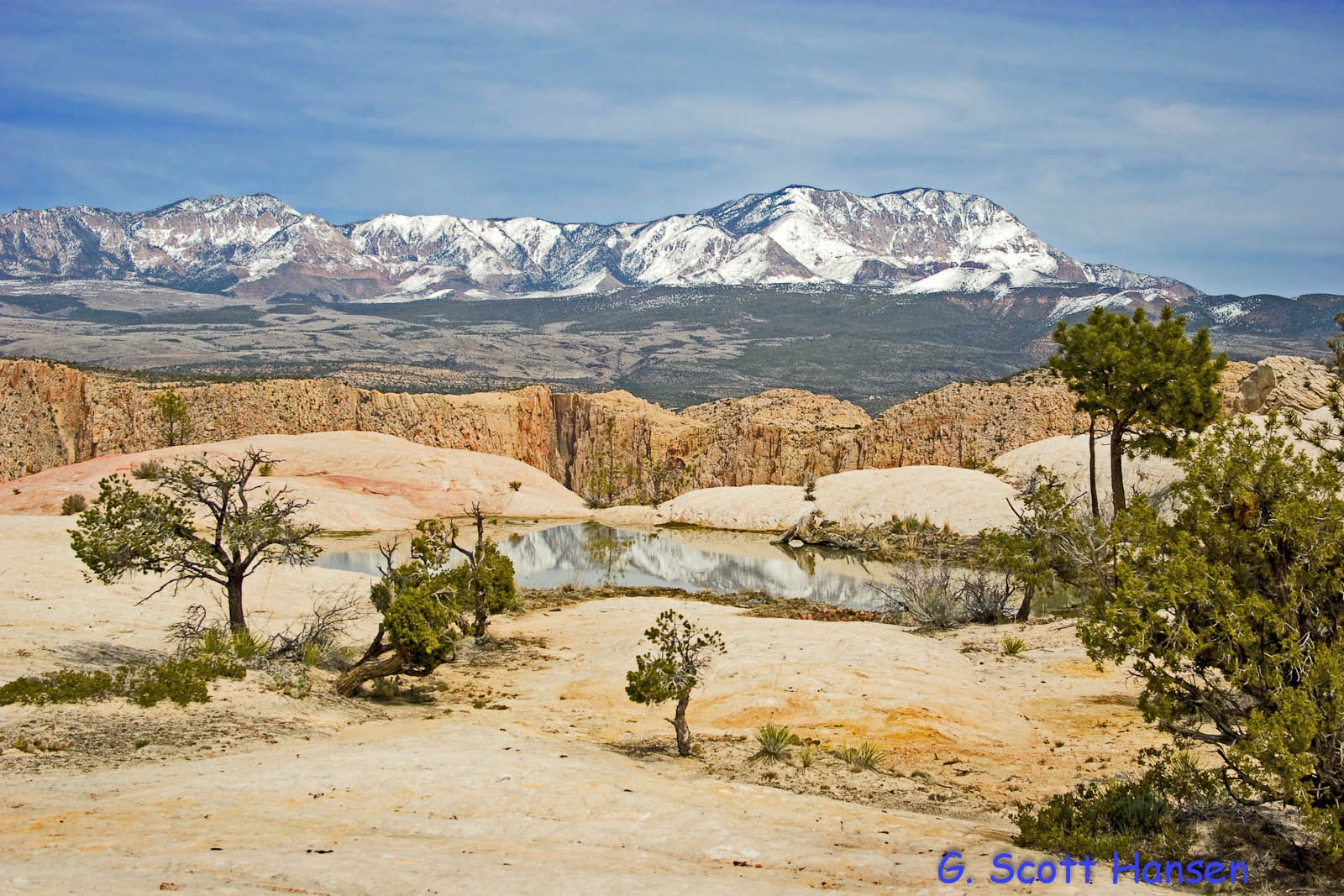
- Beautiful winter view in White Rocks area with snow capped Pine Valley Mountain in the distance.
-

- Hikers enjoying springtime floral displays on top of Red Mountain.
-
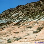
- Hikers on slick rock coming-out of White Rocks area.
-
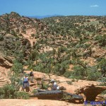
- Lots of red rock in Pinyon-Juniper habitat in areas with no designated trails. Topo maps, GPS, and knowledgeable guides can keep hikers from getting lost.
-
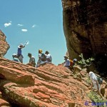
- Group of guided hikers resting in the Gunsight Notch.
-
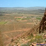
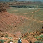
- View towards Ivins, from Gunsight Notch.
-
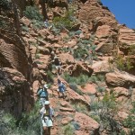
- Hikers coming down the rocky Gunsight route.
-
- Hikers making their way down the steep gunsight route.
-

- Gunsight trailhead and step-over on Tuacahn Drive.
-
- Hikers follow the main Red Mountain user trail down the steep cliff face near the end of the trail.
-

- Steep and or rocky sections require careful scrambling.
-
- The trail ends in a faint dirt path at the bottom of the mountain.
-
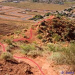
- Alternate routes down south face of mountain.
-
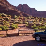
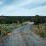
- The Ivins trailhead at the North end of 200 East in Ivins City serves both the Red Mountain and Gunsight trails.
More Information
Contact
Washington County HCP Administration
111 E. Tabernacle St.
St. George, UT 84770
(435) 301-7430
![]()
![]()
![]()