Virgin River Trail
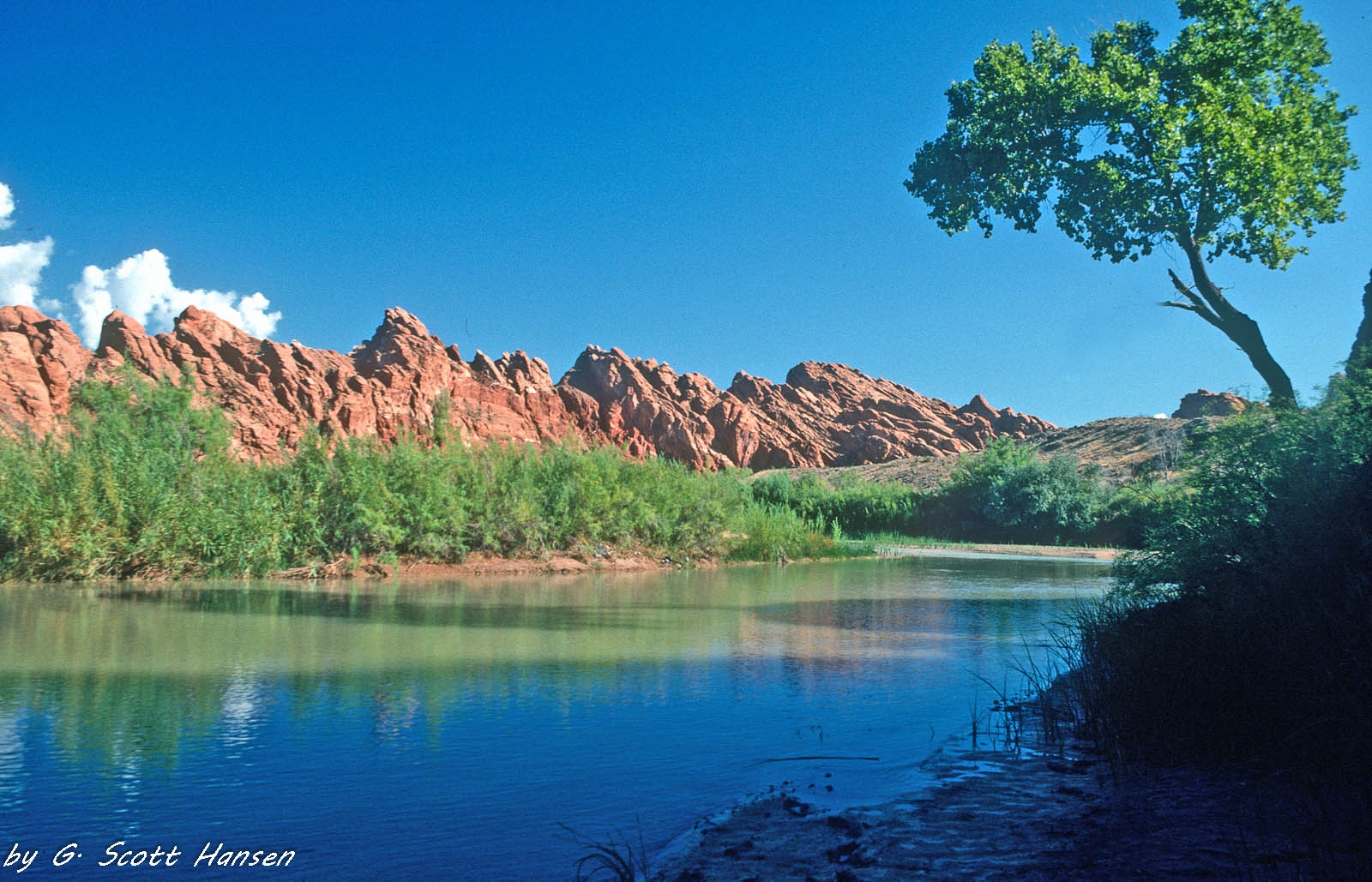
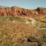
The strenuous Virgin River trail (or route) runs approximately 6 miles from its east end in the Confluence Park area outside of the Red Cliffs Desert Reserve in the city of Hurricane to its western end below the south end of the Babylon Road. That portion of the trail coming out of Confluence Park on the south side of the river is easy and fairly well established by users but not marked or regularly maintained. Proceeding further to the west, hikers will often have to wade through portions of the Virgin River, crossing it in several locations, depending on water flows and migration of the river bed. Hikers are cautioned to avoid periods of high flows and heavy precipitation when the river is subject to flooding and to dress appropriately for the conditions that will be encountered. The western portion of the trail is primarily an unmarked route with segments of visible, user-established trails and other segments entirely in the river or maneuvering through willow thickets on the northern and southern banks. The substrate consists of soft sand, slippery rocks, wet soils, and river debris throughout much of its length. Views include a canyon gorge environment with high, steep, volcanic cliffs, beautiful riparian systems, water fowl, abundant wildlife, and red rock formations near the western end of the route. Elevation drop from the east end in Confluence Park to the west end at the Babylon Mill Site is about 180 feet. The route is closed to motorized vehicles inside the Red Cliffs Desert Reserve and is generally unsuitable for bicycles. Portions of the trail outside of the Reserve are comprised of private lands and part of the Confluence Park administered by Washington County and numerous state and local partners. Portions inside the Reserve are administered by the BLM within the Red Cliffs NCA.
-
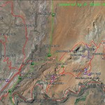
- The Babylon Area Map shows the relationship of the Virgin River trail with all other trails in the Babylon complex.
-
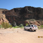
- Visitors to the west end of the trail typically park at the south end of the Babylon Road to enjoy the river system.
-
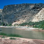
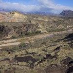
- Visitors will have views of black and white lava cliffs along the western portions of the trail.
-
- Further to the east, the trail may be accessed from the south end of the popular arch trail at this ox bow on the river. The trail itself is a faint user trail crossing the middle of the ox bow.
-
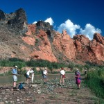
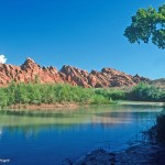
- Most of the trail is unmarked and visitors find their way, looking for sand and gravel bars to safely walk on below beautiful cliffs and deep blue skies.
-

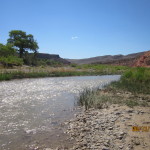
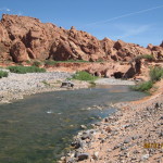
- Through some portions of the trail visitors must wind their way through thickets of willows, cottonwoods, and other dense vegetation. River crossings are common.
-
- Hiking or horse back riding is relatively easy when river flows are low during the dry seasons of the year.
-
- During the wet seasons, the river can run deep and wide and require discretion and preparation on the part of all visitors.
-
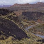
- Towards its east end the river winds through black lava canyons of considerable height.
-
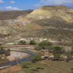
- As it nears its end to the north, the river flattens out and provides an easier and visible path for visitors on the south side of the river.
-
- The trail ends outside of the Red Cliffs Desert Reserve in the Confluence Park managed by a consortium of local agencies and the Virgin River Land Preservation Association. It connects into the Confluence Park trail system and can be accessed from multiple points in the Park.