Cottonwood Canyon
The Cottonwood Canyon trail is one of the most scenic trails in the RCDR. This difficult (length, bolder-hopping) trail/route extends about 7.8 miles from the Danish Ranch Road on the Dixie National Forest to the Cottonwood Trailhead off I-15 with an elevation loss of about 1300 feet and total elevation change of about 1400 feet. The trail/route is almost entirely in the Cottonwood Canyon Wilderness Area and is unmarked except for the short section outside the Wilderness area. A GPS unit is very helpful in the upper sections.
The trail may be readily accessed from the Danish Ranch Road on the Dixie National Forest from Leeds on the east or the Cottonwood Road on the west about 200 yards east of where the road crosses Cottonwood Creek. High clearance vehicles are a must. There is no parking area or trail sign, only one small pullover. The creek will be found adjacent to the road and should be followed into the canyon heading south (sometimes wet but more often dry). Even when water is running from the headwaters, it usually disappears at some point down the wash well before it reaches the lower sections of the canyon. The canyon should not be traversed during or shortly after precipitation events since high water floods carry large rocks and debris and can be fatal.
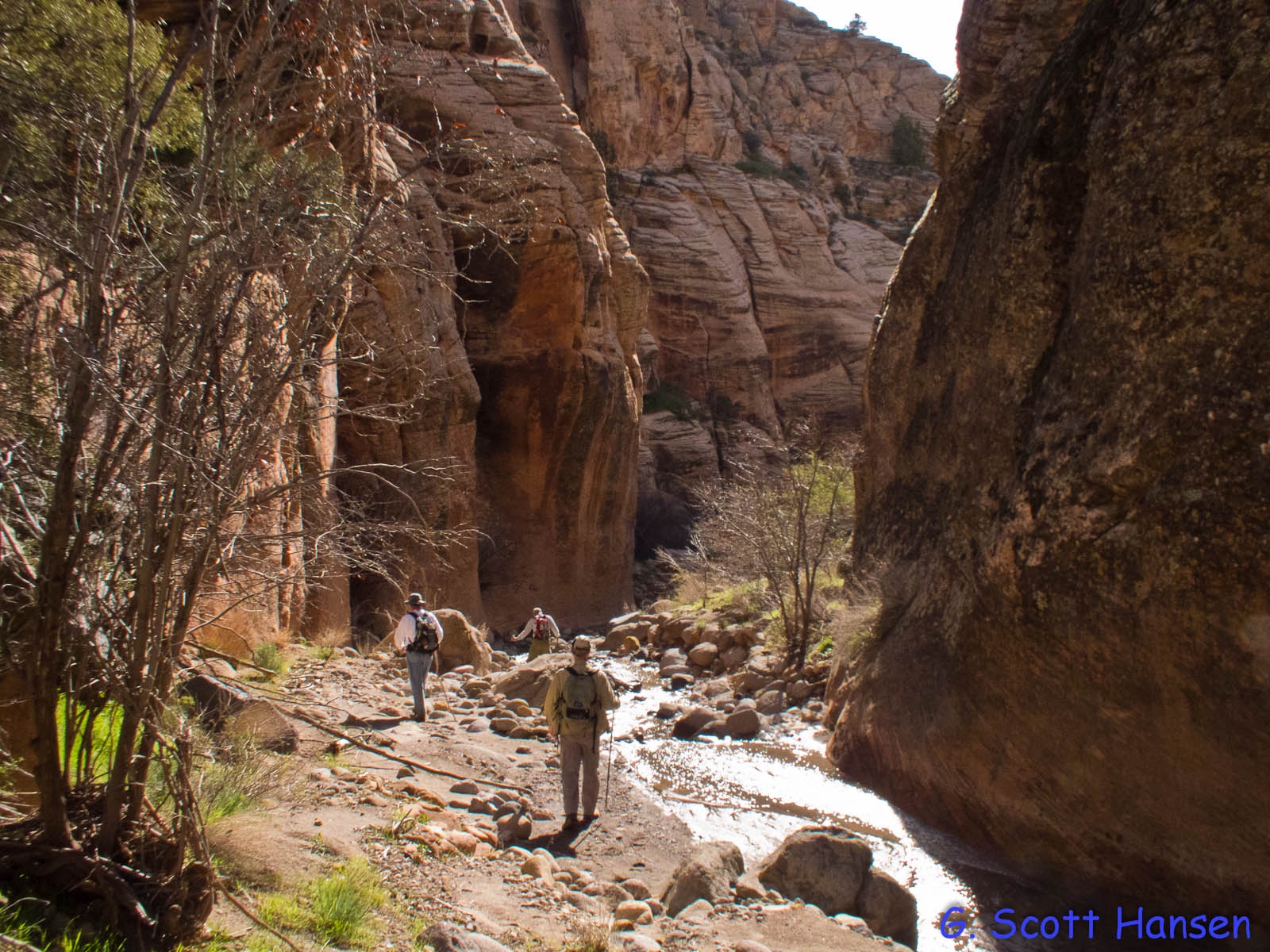
The route down is almost entirely in the wash bottom for the first 6 miles. The wash bottom is sometimes sandy but more often very rocky with large boulders. At a point about 0.6 mile down from the Heath Canyon junction, a dirt path can be found above the rocky wash. The dirt trail crosses the wash several times and eventually becomes a 2-track (old road) trail as it leaves the Wilderness Area and continues for about 1 mile to the Cottonwood trailhead. In the upper reaches of the canyon, outstanding views of the red rock high country in the wilderness area can be seen which rival portions of upper Zion National park. Several checkerboard sandstone peaks and lots of remarkable formations of varying colors abound along the route. In the lower sections, historical features including a pioneer aqueduct and related tunnels cut through the Navajo sandstone can be found. Mule deer, coyotes, foxes, bobcats, and cougars frequently use the canyon as passage through the wilderness area and leave lots of sign in the sand. Summertime temperatures are often extreme, above 100 degrees, and there is often no cell phone coverage in the canyon portions. Visitors must go prepared accordingly.
To do the top to bottom hike, a shuttle of about 22 miles from the Cottonwood trailhead to the starting point on the Danish Ranch Road is required. Another possibility would be to hike down Heath Canyon and up Cottonwood Canyon (or visa-versa) with a shuttle between the start/end points (about 3.2 miles) on the Danish Ranch Road. The Cottonwood Canyon route from the Danish Ranch Road to the Heath Canyon junction is about 5.4 miles and the Heath Canyon route from Danish Ranch Road to the junction is about 3.5 miles.
For ease and convenience, most visitors access the trail from the Cottonwood trailhead off Interstate Highway 15 at the bottom of the canyon and hike up as far as time and energy will allow. Follow the signs for the first 2/3 of a mile and turn right on the Prospector trail which coincides with the Cottonwood Canyon trail for a short distance till the two split with the latter continuing on the left. The trail is relatively easy in the lower portions but not nearly as scenic as the upper sections which are usually missed due to time and commitments. The Heath Canyon junction is about 2.4 miles from the trailhead. The most striking parts of the canyon are above this junction. The Wilderness Area is in the “upland zone” of the RCDR, so off-trail hiking and exploring is allowed, and there are a number of areas and side canyons that can be explored. Wildflowers in the spring after good rains can be exceptional, particularly in the upper regions. For those portions of the hike in the Wilderness Area, all vehicles and bikes are prohibited. Equestrian use is common in the lower portions but limited higher up due to narrow canyon bottoms with lots of boulders wall to wall. Below the National Forest Boundary, the trail lies entirely on lands administered by the Bureau of Land Management within the Red Cliffs National Conservation Area.
-
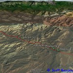
- Cottonwood Canyon trail with key intersections (7.8 miles from Cottonwood trailhead to junction with Danish Ranch Road).
-
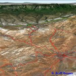
- This area map shows the relationship of the Cottonwood Canyon trail to all other trails in the vicinity.
-
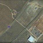
- Cottonwood trailhead aerial photo showing its location behind industrial park and Interstate 15 underpass.
-
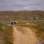
- Trail from Cottonwood trailhead looking back to the east. Begins as a two-track suitable for hikers, bikers, and equestrians.
-
- Cottonwood Canyon trail parallels the Prospector trail to the north until the Prospector trail splits off to the right. Cottonwood Canyon continues to the left.
-
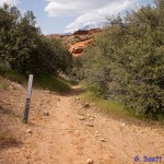
- The two-track becomes a single track trail at the wilderness boundary shown here. There are no signs beyond this point.
-
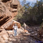
- The trail continues above Cottonwood Creek before dropping down into the wash.
-
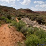
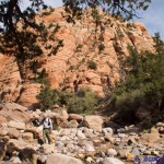
- The trail drops down into the wash for much of its length.
-
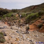
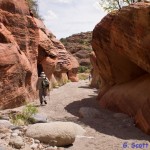
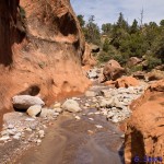
- The wash bottom is heavily bouldered along portions throughout the canyon. User trails are often found to help hikers and equestrians get around such sections.
-
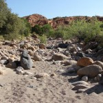
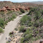
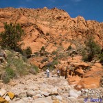
- Lower segments of the trail offer a mix of sand and boulders.
-
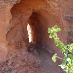
- Historic use of the canyon by early pioneers include multiple tunnels through sandstone bedrock above the wash to accommodate acqueducts bringing precious water to St. George from the Pine Valley Mountains.
-
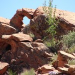
- Observant visitors may see features such as this nice unnamed arch above the canyon bottom.
-
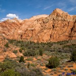
- As one travels farther north the geologic features and canyon walls become a significant part of the landscape.
-
- Small slot canyons occur throughout the canyon bottoms as travelers proceed to the north.
-
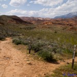
- Toward the upper regions, red and white sandstone cliffs form magnificent backdrops to the canyon bottoms.
-
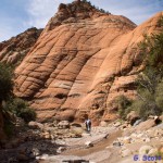
- Spectacular checkerboard sandstone formations abound in the upper canyon, much like portions in Zion National Park.
-
- Waterflows occur in the upperwash during spring runoff and heavy rains.
-
- Moving out of the wash bottoms to upland areas provides spectacular back country scenery like this array of Navajo sandstone peaks.
-

- The canyon narrows significantly as you cross into the Dixie National Forest near the Danish Ranch Road.
-
- Cottonwood Creek parallels the Danish Ranch Road at a point where the canyon is easily accessed. A good starting point for hikers traveling from top to bottom and ending at the Cottonwood trailhead.