Scout Cave
The Scout Cave trail is very popular with local hikers and committed bikers. The southern portion is also used by equestrians. The trail can be accessed from the south via the Gila trail in Paradise Canyon or from the north via the Johnson’s Canyon or Kestrel trails.
The Paradise Canyon route to the caves may start from either the Gap trailhead via the Gecko and Paradise Rim trails or the Chuckwalla trailhead via the Chuckwalla and Beck Hill trails. A short distance from the beginning of the Gila trail at its junction with Beck Hill, visitors may take the unsigned Scout Cave trail (firm soil and/or rocky) to the left or the signed trail (soft sand suitable for equestrians) about 200 yards further north. The dirt and rocky, single-track trail heads west and up to the slick rock rim and continues for about 0.2 mile before it starts the descent down to the cave area. The first few hundred yards down are steep in places and very rocky throughout. The distance from the Gap trailhead to the caves is about 2.5 miles with about 800 feet elevation change. The trail is of moderate to strenuous difficulty due to the steep, rocky sections. This section would also be a deterrent for most bikers and all equestrians.
The northern route is via the Johnson’s Canyon trail. About 0.5 mile from the Johnson Canyon trailhead on Snow Canyon Drive, the Scout Cave trail takes off to the right and heads south over a large, lava bed. The singe-track trail is rocky (lava) until it drops down into the wash (about 1 mile from trailhead). After the drop, the sandy trail continues above or through the wash for about 0.5 mile and then heads east up a side wash to the caves. The distance from the trailhead to the caves is about 2.0 miles with an elevation change of about 850 feet. The lava rocks on the first half of the trail would be a challenge for bikers and is of moderate to strenuous difficulty for all other visitors.
The entire trail may be hiked from end to end with the use of a shuttle or a long loop hike using city trails outside the Reserve/NCA. Total elevation change is about 1650 feet. The northern trailhead is about 100 feet higher than the southern. Both routes provide nice views from the rims and of the spectacular red sandstone cliffs along much of the trail. The caves are interesting formations to explore and require rock scrambling to enter. Please respect the environment throughout the trail and in the caves by carrying out all refuse and litter.
-
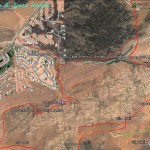
- This map shows the Scout Cave trail and its relationship to the Johnson Canyon, Kestrel and Gila trails.
-
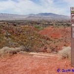
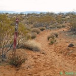
- Visitors accessing the trail from its eastern end in Paradise Canyon will start at this junction with the Gila trail.
-
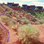
- The trail heads due west and joins an alternate route from the north, used most frequently by equestrians seeking a more sandy substrate.
-
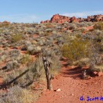
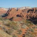
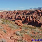
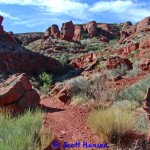
- Visitors will climb towards the top of a sandstone ridge that provides excellent views in all directions.
-
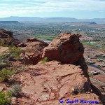
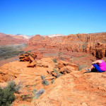
- To the south, visitors will enjoy views of the St. George metropolitan area and distant mountains far into the state of Arizona.
-
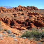
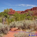
- To the north, visitors will enjoy views of rugged, red sandstone formations.
-
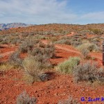
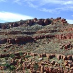
- Leaving the ridge, visitors will begin a descent following a moderate dirt trail.
-
- Further down, the trail steepens considerably on a rocky surface as it heads towards the canyon.
-
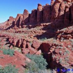
- This view from across the canyon shows the steep slope that visitors must descend through a series of switch-back trails.
-
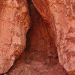
- Part way down the descent, visitors will have to squeeze through this narrow slot on their way to the canyon.
-
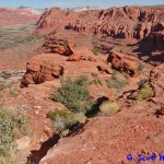
- On the north side of the canyon, visitors will continue heading west on this ridge above the canyon floor and below the steep cliff faces.
-
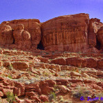
- Visitors will reach the bottom of the Scout Cave’s formation at about 1.2 miles from the start of the trail.
-
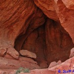
- The main cave requires a little rock scrambling to get visitors into a large single-room cavern.
-
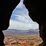
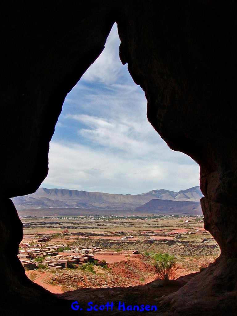
- Interesting views to the south can be enjoyed from within the cave.
-
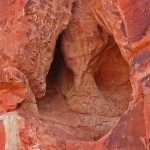
- A second cave opening is found in close proximity but is extremely difficult to get into without special equipment. The grotto is quite small.
-
- The 3rd cave opening also offers a difficult challenge to get into without special equipment.
-
- Continuing on the trail to the southeast, visitors will hike along a causeway until reaching this entry into the deep drainage where they will descend on a crude stairway to the bottom of the gulch.
-
- Visitors will then follow the bottom of this gulch along a sandy and rocky substrate.
-
- The trail winds below a residential development and requires visitors to take this go-around to avoid a steep dry fall in the wash bed.
-
- The trail enters a major wash near the junction of the Kestrel trail and turns back to the northwest.
-
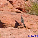
- Abundant desert wildlife is often seen throughout the bottoms of the washes including rabbits, lizards, quail and an occasional road runner.
-
- The trail leaves the wash bed and continues along a lava strewn segment in the upland area.
-

- As visitors near the west end of the trail, they will encounter excellent views into Johnson Canyon.
-
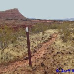
- The trail ends at this junction with the Johnson Canyon trail.