Winchester
The Winchester trail is accessed on its east end from the Yellow Knolls trailhead parking area off the Cottonwood Road. From its stepover on the south side of the road, the trail winds along an old two-track for two miles before terminating at the Winchester gate and step-over at the private land boundary immediately southeast of the community of Winchester Hills. The trail consists primarily of packed dirt and gravel but passes through some sections of rock and cinder. The trail has numerous ups and downs but starts and ends at about 3900 feet of elevation. Lightly used, the trail offers visitors a hilly but moderate to relatively easy hike or ride through dry shrubland areas with views of Arizona mountains to the south and Utah Hill and Red Mountain to the west. After seasonal rains, the trail is often overgrown with grasses and weedy shrubs and some spotty places with abundant floral displays. The two-track is an historical road used by early European pioneers to travel from Washington City and St. George to settlements to the northwest. It now serves throughout much of its length as an occasionally-used maintenance road for power lines that cross the area. The trail provides direct access to the south end of the Black Gulch trail and can be used to form excellent loop trail options with that route as well as the popular Yellow Knolls trail. A direct northerly connection to the Lange’s Dugway trail is now overgrown and completely indistinguishable. Visitors accessing the Winchester trail from the west end will cross private lands on unmaintained dirt roads and should respect private property including the equestrian center immediately to the south. The trail, itself, lies entirely on lands administered by the Bureau of Land Management in the Red Cliffs NCA.
-
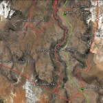
- Winchester area trail map.
-
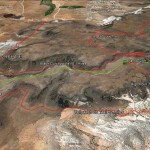
- This map shows how the Winchester trail can be used in connection with the Black Gulch, Yellow Knolls and High Point trails to form an excellent but strenuous six mile loop hike.
-
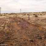
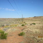
- Entrance to the north end of the Winchester trail is made through this stepover off the Cottonwood Road across from the Yellow Knolls trailhead.
-
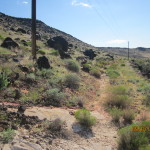
- The trail starts off as a dirt maintenance road that is well marked with trail signs.
-
- The trail continues across the upper flats in a semi-rocky environment.
-
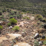
- The trail drops down the steep slope with a rocky and lava substrate.
-
- About 1/2 mile from the stepover, visitors will find the south connection with the Black Gulch trail that offers a nice loop opportunity.
-
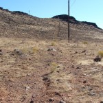
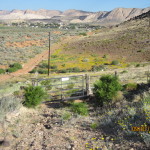
- Most of the trail follows a lengthy powerline and serves as the principal maintenance road.
-
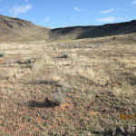
- Portions of the trail are characterized by dry grassy fields left over from large, disastrous wildfires in past years.
-
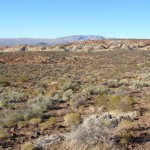
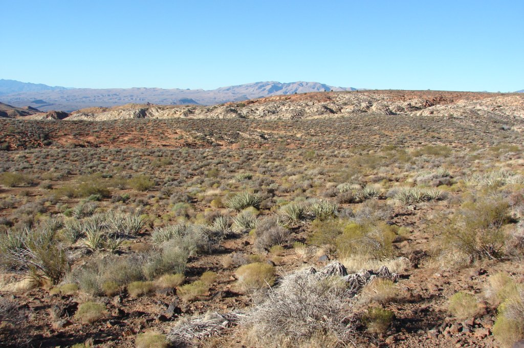
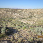
- Views to the southwest from portions of the trail include this typical upland desert environment.
-
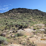
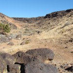
- In several places the trail runs below black lava covered slopes.
-
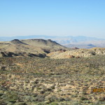
- From the higher places on the trail, visitors will be able to observe mountains as far as Arizona and the Nevada border.
-
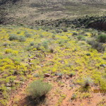
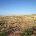
- During wet years visitors will experience weedy growth covering portions of the trail.
-
- The trail includes numerous ups and downs including a descent into this bowl-like valley.
-
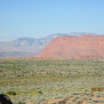
- Near the west end of the trail visitors will be able to enjoy vistas of Red Mountain and the Beaver Dam mountains.
-
- Portions of the trail will include short sections of bedrock and rocky debris.
-
- Other portions of the trail will run through moderate slopes with large lava boulders.
-
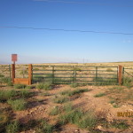
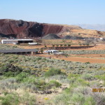
- The trail terminates at the south end at this gate and stepover at the boundary of the Red Cliffs Desert Reserve and private land. The community of Winchester Hills is seen in the distance.
-
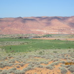
- From the gate, visitors will also observe the Ledges Golf Course and portions of Snow Canyon State Park.
-
- To the southwest, visitors will see a large equestrian facility on private land. Visitors need to have permission from the owners to cross this private property.