Red Tail
The moderately difficult Red Tail trail is reached by horse or on foot out of the Sand Cove area by taking the Sandstone Mountain trail till it reaches the crest of the Sandstone Mountain ridge after an elevation gain of about 550 feet. Turn to the left at the main north/south trail junction which begins the northern end of the trail consisting of a well-used jeep road that is partly rocky and partly sandy in nature. Continue about 1/3 mile and take the right fork at the next junction and follow the trail down slope another 2/3 mile to the east border of the Red Cliffs Desert Reserve. At that point, the trail continues across private lands and takes visitors into the LaVerkin area. Elevation loss from the northern end to the east boundary is 400 feet. The trail is most popular with equestrians and ATV riders and is open to motorized travel. The trail is usually ridden as part of an extended loop system often including the Raven trail or that segment of the Sandstone Mountain trail open to motorized vehicles. Views to the south and east include the Hurricane Cliffs, portions of Zion National Park, Gooseberry Mesa, and portions of the Hurricane Valley. Views to the west from the upper elevation include the Pine Valley Mountains and surrounding red rock formations. Many visitors access the trail from the east out of Toquerville and LaVerkin on established equestrian or ATV routes. Partly on lands administered by the BLM within the Red Cliffs NCA, the route at its northern end runs across land administered by the Utah School and Institutional Trust Lands Administration (SITLA).
-
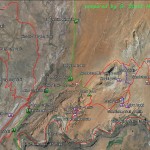
- The Babylon Area Map shows the relationship of the Virgin River trail with all other trails in the Babylon complex.
-
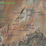
- The Sandstone Area map shows the Sand Cove access trail and all linkages to adjoining trails in the Sandstone Mountain complex.
-
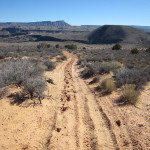
- The Red Tail trail starts at this junction with the Sandstone Mountain trail on top of the saddle and heads northeast before breaking south.
-
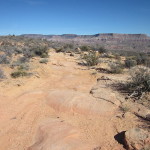
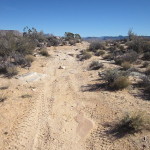
- The Red Tail trail on top is a mixture of sand, dirt and slick rock as shown in this photo.
-
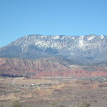
- Views from the top include this spectacular view of the Pine Valley Mountains and Cottonwood Canyon area to the west.
-
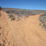
- About 1/3 mile from its start, the trail breaks off to the right and heads south for the balance of its one mile length.
-
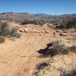
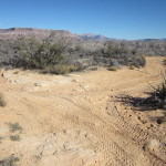
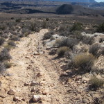
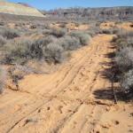
- The trail consists entirely of an old jeep road and includes portions that are rough and sandy as shown here.
-
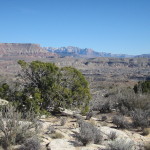
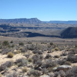
- Views to the south include this view of the Hurricane Mesa and Zion National Park.
-
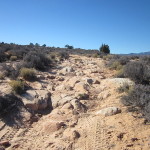
- Some portions of the trail are very rough and rocky, especially in the middle section.
-
- Other sections of the trail include steep inclines with rocky and powder-like soils.
-
- Views to the south include the Virgin River canyon, Gooseberry Mesa and portions of the Hurricane Valley community.
-
- The Red Tail trail joins with the Raven trail at this junction near its south end.
-
- The trail continues at its south end across sage brush flats as it nears the Virgin River.
-
- The trail ends at this unmarked point on the east boundary of the Red Cliffs Desert Reserve and continues on towards the communities of Toquerville and LaVerkin.