T-Bone
The T-Bone trail starts at its south end from the picnic parking area inside St. George City’s popular Pioneer Park off the Red Hills Parkway. It links up with the Pioneer Rim and Pioneer Hills trails to provide nice opportunities for loop hikes of easy to moderate difficulty. The trail itself is 1.8 miles long, ending at a stepover and small parking zone off the Cottonwood Road about 1.2 miles north of the St. George Industrial Park. Net elevation gain from the southern trailhead to the northern trailhead is 140 feet. Total up and down elevation change is about 450 feet. The trail is graveled at its south end to provide safe travel for city and utility crews maintaining water and power lines along the route. Less than ½ mile from its start, the trail becomes a dirt two-track that winds north among desert hills and valleys that display creosote and desert shrubs along with abundant floral shows in wet springs. By linking the Pioneer Rim trail with the Pioneer Hills trail on the east end, T-Bone offers visitors a comfortable and enjoyable 2-mile loop hike from which may be seen views of the St. George metropolitan area to the south, a red rock fantasy land in the middle, and views of the distant Pine Valley Mountains to the north. Approaching the northern trailhead, visitors will encounter a moderate climb up a lengthy hill over a lava rock substrate of moderate difficulty.
-
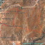
- This map shows the relationship of the T-Bone trail with all of the linking trails in the Pioneer Park area of St. George.
-
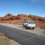
- The main trailhead is accessed in the picnic area of Pioneer Park. Parking is available for numerous vehicles in this area.
-
- Here the popular Pioneer Rim trail crosses the graveled T-Bone trail at an important junction used by many visitors to this popular area.
-
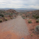
- The T-Bone trail continues for about 1/2 mile on a gravel substrate.
-
- After becoming a dirt, two-track trail, T-Bone is joined by the Pioneer Hills trail that comes out of the Pioneer Hills trailhead off of the Red Hills Parkway north of the city park.
-
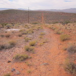
- Much of the T-Bone trail follows a large transmission line and serves as maintenance access.
-
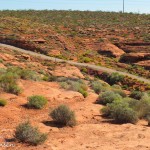
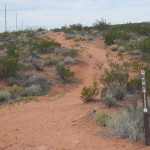
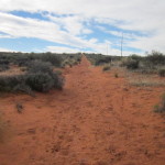
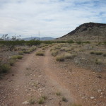
- Throughout its length, the T-Bone trail has many ups and downs but remains easy to moderate in its difficulty.
-
- Portions of the trail can be very sandy which makes it somewhat more difficult for bikers and some hikers.
-
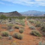
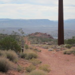
- Views from the trail to the north include T-Bone Mesa and the distant Pine Valley mountains.
-
- Nearing the north end of the trail the substrate becomes black lava rock which can be tough on feet and bicycle tires.
-
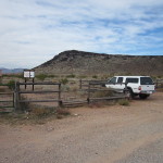
- The trail reaches its north end at this trailhead located on Cottonwood Road, 1.8 miles from the trail’s start.