Cottonwood (Turkey Farm) Road
The Cottonwood Road, also known locally as the Turkey Farm Road, serves as a major connector serving six trailheads that link directly to ten trails and indirectly to four others inside the boundaries of the Red Cliffs Desert Reserve and National Conservation Area. The road and associated right-of-way serve as a trail for motorized vehicles, bikers, and equestrians and connects area visitors to the Dixie National Forest road network on the north boundary of the Reserve/NCA. Access to the road is generally made from the south through the St. George industrial park adjacent to the eastern part of the Red Hills Parkway. The road crosses the south boundary of the Reserve just north of its intersection with the Red Rock Road that comes out of the industrial park. From that point the road is paved for a distance of 2.3 miles, with more than a few potholes. For the remaining 5.4 miles, the road is a graded dirt road maintained by the county but subject to wash-boarding, exposed rocks, and muddy conditions during and after heavy rains. Visitors are cautioned to drive carefully and to be considerate of other users along the road. From its south end to its northern terminus at the boundary of Dixie National Forest, the road rises about 1500 feet in elevation with the sharpest rise occurring in the more northerly section. For those moving beyond the road onto the Danish Ranch Road on the Dixie National Forest, be aware of the likelihood of very rough and narrow sections that require high-clearance vehicles.
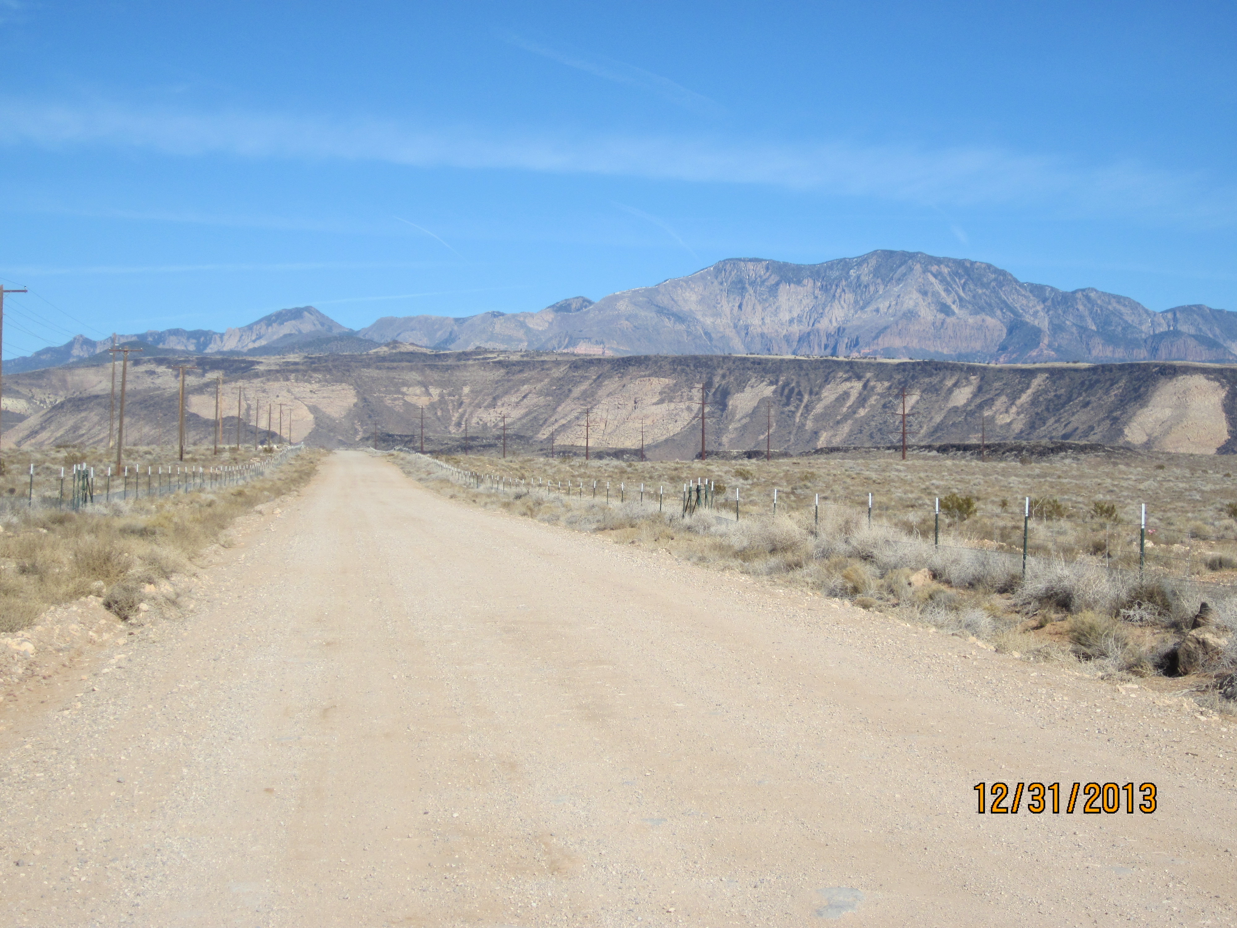
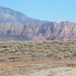
Views to the north provide visitors with panoramic displays of the Pine Valley Mountains, sandstone escarpments capped with black lava flows, and occasional glimpses of red sandstone peaks in the Cottonwood Canyons and other areas of the Reserve. Views to the south include southern mountain ranges in Utah and northern Arizona and the Beaver Dam Mountains to the southwest. Historic features along the road include a lava rock retention dam built by early pioneers and historic and modern pipelines and aqueducts that bring water to St. George from the Pine Valley Mountains. Many of the visible jeep trails served as historic wagon roads to facilitate delivery of goods, ice, and supplies to pioneer families and communities scattered throughout the Washington County area. Contemporary facilities include a major electrical power station one mile north of the south boundary with sizable transmission lines coming in from the north and dispersing to the south to serve nearby towns and cities, and a large municipal water tank serving portions of the metropolitan area.
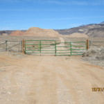
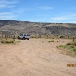
From the southern end, visitors travel the following distances to reach the various trailheads and stepovers along its route: 1) T-Bone trailhead with good parking – 1 mile; 2) Tank trailhead with limited parking, directly serving the Middleton Powerline trail and indirectly serving the Ice House, Cottontail, and Mustang Pass trails – 2 miles; 3) Black Knolls stepover with no suitable parking – 3.5 miles; 4) Winchester stepover and Yellow Knolls trailhead with good parking – 4.7 miles; 5) Black Gulch trailhead with good parking, also serving the High Point, Yellow Knolls, Lange’s Dugway, and Alger Hollow trails – 6.1 miles; 6) Broken Mesa trailhead with good parking, serving also the Ice House trail – 7.3 miles; 7) Dixie National Forest boundary – 7.7 miles. Small portions of the road near the southern end cross private, state, and municipal lands, while the majority of the road crosses lands administered by the BLM within the Red Cliffs NCA.
-
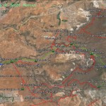
- This map shows the Cottonwood Road with all of its trailheads and linkages to the numerous trails that exist throughout this portion of the Reserve/NCA.
-
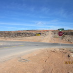
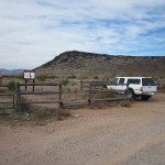
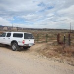
- The Cottonwood Road begins at this intersection with the Red Rock Road coming out of the St. George Industrial Park.
-
- The road runs entirely through the Red Cliffs Desert Reserve established in February 1996.
-
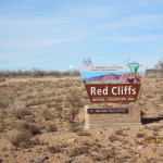
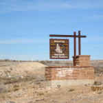
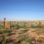
- In 2009 public lands within the Red Cliffs Desert Reserve were designated as the Red Cliffs National Conservation Area as indicated by this sign near the south boundary.
-
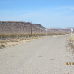
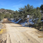
- From the south end the road is paved for a distance of 2.3 miles and maintained by city crews.
-
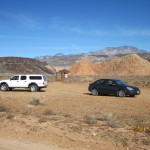
- Visitors will find the first trailhead one mile from the start to access the T-Bone trail heading back to the southwest.
-
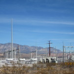
- A major powerline station serving much of Washington County, Utah is seen on the east side of the road.
-
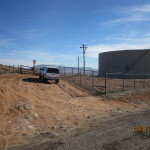
- At two miles, visitors will reach the second trailhead providing access to the Middleton Powerline trail starting next to a large municipal water tank.
-
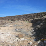
- Historic features such as this lava rock detention dam may be seen along the roadway as well.
-
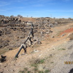
- On the west side of the road, visitors may see historic and current pipelines and aqueducts bringing water from the Pine Valley Mountains into the St. George area.
-
- The final 5.4 miles of the road consist of graded dirt maintained by county road crews. The road can be rough and rocky, particularly after rains.
-
- At 3.5 miles visitors will find the stepover to the Black Knolls trail which has no parking but just enough pullover space for one vehicle.
-
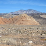
- From the main road, visitors will get occasional views of the spectacular red sandstone cliffs of the Cottonwood Canyons.
-
- Further up the road visitors will pass the access road into the Turkey Farm property now managed by the state of Utah as a research facility.
-
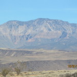
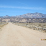
- Throughout the length of the road visitors will have panoramic views of the Pine Valley mountains located to the north.
-
- Other formations, such as this colorful outcrop, known as the Yellow Knolls, will stand out and make for some good picture taking.
-
- At 4.7 miles, visitors will reach this stepover on the south side of the road to access the Winchester trail.
-
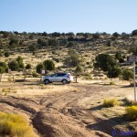
- Across the road from the Winchester stepover, visitors will find a spacious parking area and trailhead for the popular Yellow Knolls trail.
-
- At 6.1 miles, visitors will reach the Black Gulch trailhead which serves as an access point for the Lange’s Dugway, Alger Hollow, High Point and Yellow Knolls trails.
-
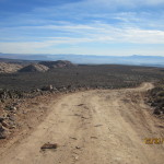
- Proceeding further up the road, visitors will climb in elevation through a dirt and windy section that can be troublesome during rains.
-
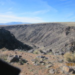
- Occasional views may also be had into the Black Gulch ravine on the west side of the road.
-
- At 7.3 miles, visitors will reach the final trailhead at this location for the Broken Mesa trail and its connection to the Ice House trail.
-
- At 7.7 miles visitors will reach the north end of the road where it enters the Dixie National Forest and becomes the Danish Ranch Road.