Middleton Powerline
The Middleton Powerline trail follows a two-track, dirt maintenance road beginning from the west on the north side of the municipal water tank part way up on the Cottonwood road north of the city of St. George. Parking at this point (Tank trailhead) is limited to one or two vehicles with additional space in a pullout across the road. The trail runs underneath transmission poles for 3½ miles to its intersection with the Mill Creek trail on the east. The trail consists of packed dirt and a few sandy stretches throughout its length and can be quite muddy during and after heavy rains. When dry, the trail is relatively easy hiking and riding with some modest ups and downs from end to end. Elevation change from one end to the other is 300 feet with a moderate drop-off from the west end. Total up and down change is about 400 feet. The trail provides a connector for the Cottontail, Ice House, Mustang Pass and Mill Creek trails. The Black Knolls trail was originally intended to join Middleton Powerline from the north. BLM has not yet determined how and when that connection will be made. The Middleton trail is not open to motorized travel by the public but will be sparingly used by wildlife agency officials, powerline crews, and emergency personnel to conduct resource management, maintenance, and emergency operations. The trail is often used by equestrians to complete loop hikes throughout portions of the Red Cliffs Desert Reserve. Most of the trail crosses lands owned by the State of Utah through the Division of Wildlife Resources or SITLA. A small portion of the trail crosses private land near the west end and lands administered by the BLM in the Red Cliffs NCA.
-
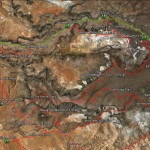
- This area map shows the Middleton Powerline trail along with all other linkages to adjacent trail systems.
-
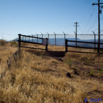
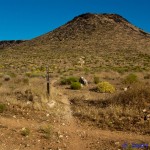
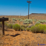
- From the west end, visitors may park at this small trailhead parking area adjacent to the large municipal water tank that serves St. George City.
-
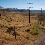
- From the trailhead, visitors will drop down the lengthy slope until hitting the valley floor underneath a power transmission line.
-
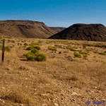
- The trail is primarily a two-track used for maintenance and resource management. The Cottonwood Canyons Wilderness Area is visible in the far distance.
-
- The trail serves as access to the south end of the Ice House trail which runs several miles to the north boundary with the Dixie National Forrest.
-
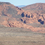
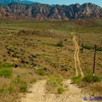
- Views to the north include red rock hills and formations like these shown above.
-
- Near its eastern end, the trail connects with the Mustang Pass trail at this junction.
-
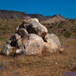
- Visitors may be amused by this sizable rock cairn located near the eastern end of the trail.
-
- After 3.5 miles the trail ends at its eastern terminus with the Mill Creek trail which serves as an alternate means of access to the Middleton Powerline trail.
BLM website for Middleton Powerline