Broken Mesa Rim

The Broken Mesa Rim trail starts at the Mesa Rim trailhead that is reached via a short, ¼ mile access road off of the Cottonwood Road about 7.3 miles north of the Red Hills Parkway. The moderately difficult to strenuous, single-track, rocky (lava) trail is about 4.3 miles long and climbs about 435 feet to the top of Broken Mesa. The trail follows the rim south dropping about 710 feet to the junction with the Ice House trail with a total up and down elevation change of about 1450 feet. The first ½ mile of the route may be via either a dirt switchback trail or a pipeline road. The trail passes through terrain that is mostly burnt pinion/juniper habitat with a good deal of “cheat” grass. Overall, rough and rocky, lava rock substrate may be of concern to some equestrians or bikers. The trail does, however, offer excellent views of the Yellow Knolls, the Pine Valley Mountains, and surrounding areas. From the southern end of the Broken Mesa Rim trail, it is possible to ride or hike the upper section of the Ice House trail (about 3.5 miles long) to reach the Danish Ranch Road to the north and loop back to the Mesa Rim trailhead. Visitors may also choose to ride or hike the Ice House trail to the south and exit the area through the Middleton Powerline and Mill Creek trails to reach a vehicle parking trailhead. The trail lies entirely on lands administered by the Bureau of Land Management within the Red Cliffs NCA.
-
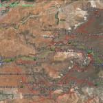
- This area map shows the relationship of the Broken Mesa Rim trail to all other trails in this part of the Reserve.
-
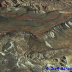
- This map shows the Broken Mesa trail in greater detail with its links to adjoining trails.
-
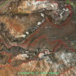
- This map shows the Broken Mesa Rim trail and its logical link to the Ice House trail, a frequently used combination to drop down into the lower portion of the Reserve.
-
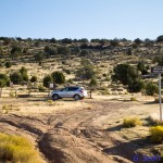
- Broken Mesa Rim trailhead is located off the north end of Cottonwood Road
-
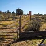
- Trailhead offers two initial routes including this stepover to a two-track road
-
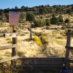
- This stepover leads to the single-track trail
-
- Single-track trail leads out of the trailhead towards the rim
-
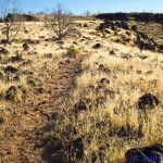
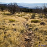
- Typical trail is shown with a mixed substrate and vegetation
-
- Portions of the trail are rocky and may include sharp-edged lava rock
-
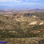
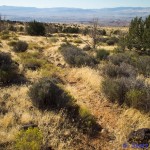
- Numerous vistas to the south make the trip enjoyable for the visitor
-
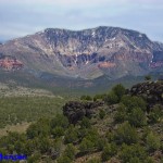
- Vistas from the trail include this view of Pine Valley Mountain to the north