Black Gulch
This moderately strenuous, lightly used route is most often accessed from the Black Gulch trailhead located on the Cottonwood Road about 2 miles west of the Yellow Knolls trailhead. To get to the start of the trail, cross the stepover to Lange’s Dugway and follow it downslope ¼ mile to the bottom of the drainage. The Black Gulch trail begins at that point and drops south for about 2 miles to its termination at its junction with the Winchester trail. The trail is a moderately scenic route winding through a narrow canyon with black, volcanic boulders that involve some rock scrambling and pools of water after rains. A few slickrock sections with sculptured features are found in the middle of the canyon. Floral displays happen at various time of the year during wet periods. The “gulch” is renowned for above average populations of rattle snakes and hikers are cautioned to be careful. The route is impossible for bikes and not recommended for most equestrians. User trails exist on upland benches in portions of the canyon to help hikers avoid some of the boulders. Elevation loss from top to bottom is about 450 feet. Hikers can make a 5-mile loop hike after leaving Black Gulch and proceeding east ½ mile on the Winchester trail and then hiking the 2-mile section of the Cottonwood Road back to the original trailhead parking area. A slightly longer but far more interesting loop is possible by doing the above-described loop and continuing on the beautiful Yellow Knolls trail across the road from the east stepover of the Winchester trail and returning to the Black Gulch trailhead via the High Point trail. Hikers may do the reverse direction of either loop by beginning their hike out of the Yellow Knolls trailhead parking area and entering the Winchester trail through its stepover across the road en route to the bottom of the Black Gulch trail. The trail and loop options cross lands entirely administered by the Bureau of Land Management in the Red Cliffs NCA.
-
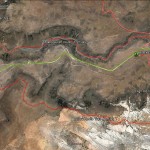
- This area map shows the Black Gulch trail and its linkages with the Winchester and Lange’s Dugway trails.
-
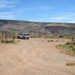
- Visitors will usually use this large trailhead on the north end of the trail to park their vehicles. Access is also provided to the High Point and Lange’s Dugway trails.
-
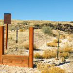
- Access to the Black Gulch trail is made through this stepover for the Lange’s Dugway trail.
-
- After passing the stepover, visitors will descend down this dugway before reaching Black Gulch.
-
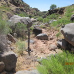
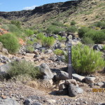
- Entry to the Black Gulch trail begins at this trail marker at the bottom of the gulch.
-
- Lange’s Dugway continues on past the entrance to Black Gulch as seen across the face of the lava escarpment above the Black Gulch trail.
-
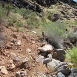
- Throughout portions of the trail visitors will find user trails located above the wash to move beyond some of the blockages in the wash bed.
-
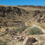
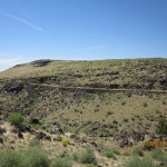
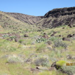
- This view is typical of portions of the Black Gulch trail and shows an open canyon environment.
-
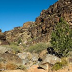
- Other portions of the trail run through narrow canyons with steep walls.
-
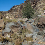
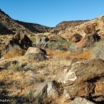
- Much of the canyon bottom is littered with large volcanic boulders that may impede visitor travel and make it impossible for bikers and most equestrians.
-
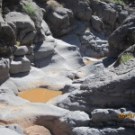
- Potholes, often filled with water, provide interesting but challenging experiences for adventurous hikers.
-
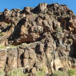
- Steep, black lava, cliff faces provide an awe-inspiring environment that dwarfs the visitor’s experience on the canyon floor.
-
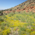
- Spring time can bring extensive floral displays throughout portions of the canyon.
-
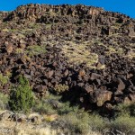
- Impressive black lava flows such as this one are found throughout the canyon.
-
- During wet years, dense vegetation will be found throughout the canyon.
-
- The trail ends about 2 miles south of its northern entry point at this junction with the Winchester trail.