Mill Creek
The Mill Creek trail consists of a sandy, utility maintenance road for its first 2.1 miles from the trailhead at the RCDR south boundary to the end of the graded road. Visitors will pass trail junctions for the Bone Wash, Middleton Powerline, and Mustang Pass trails. At the end of the road, the Washington Hollow trail breaks off to the east. From that junction to the east-west Mill Creek Canyon fork is an additional 1.2 miles. From that fork to the functional end of the west canyon route (an impassable dry-fall section) is an additional ¾ mile – a total of about 4 miles, one way. The upper segment consists of an open canyon environment with sloping walls covered in large part with volcanic boulders from the lava cap on top of the escarpment. Hikers will frequently have to scramble around large rock falls or dense vegetation to move through the main canyon. This will add distance, time, and physical effort to the hike. To continue beyond the dry-falls either requires technical equipment and expertise or a tricky climb up the canyon wall on a basaltic rock flow to the top of the plateau. However, remarkable views of the entire mountain/desert ecosystem can be seen from this point. From there hikers can continue by dropping back down into the canyon after a quarter mile (gets you past multiple dry-falls) or following the rim for close to a mile to access the Ice House trail for a long loop back to the start. Because of deep sand and very large boulder fields, the route is not suitable for bikes other than as access from the main trailhead to the Bone Wash trail. After the first 2 miles, the route inside the wash is not suitable for horses either because of the abundance of large, volcanic boulders in and above the wash. Hikers will find the left fork to be quite strenuous for the same reason. The Mill Creek east fork will take hikers ¾ of a mile into a red sandstone canyon environment without as many volcanic boulders. One or two side canyons on this fork provide some interesting options for exploration and opportunities for play in sandstone formations in the wilderness area. Floral displays in either fork can be bountiful during wet springs with Indian paintbrush, desert marigolds, four-o’clocks, primroses, sego lilies, and cliffrose, among others. Common wildlife include mule deer, coyotes, ground squirrels, cottontail rabbits, hawks, canyon wrens, a variety of lizards, and occasional tortoises, Gila monsters, chuckwallas, and snakes. The net elevation change from the main trailhead to the west fork dry falls is about 950 feet with a total elevation change of about 1260 feet (1100 up, 160 down). The net elevation change to the reasonable end of the east fork route for most hikers is about 780 feet. The trail starts on lands administered by the Utah School and Institutional Trust Lands Administration and ends on public lands administered by the Bureau of Land Management in the Cottonwood Canyon Wilderness Area within the boundaries of the Red Cliffs NCA.
-
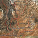
- Area map of the Mill Creek trail shows numerous linkages to other trail systems in this area.
-
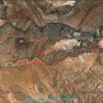
- The Mill Creek trail map shows a lower segment consisting of a city maintenance road and the upper segment of which divides into an east and west fork.
-
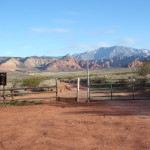
- The Mill Creek trail is accessed from the Mill Creek trailhead north of Washington City.
-
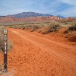
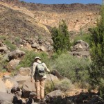
- The first two miles of the trail consists of a maintenance road serving a powerline and numerous pump houses.
-
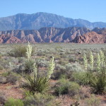
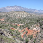
- Along the lower segment, visitors get excellent views of the distant Pine Valley mountains as well as floral displays during the spring and wet seasons.
-
- Entrance to the Mill Creek wash occurs after dropping down this jeep road that leads to the wash and the trail’s junction with Washigton Hollow.
-
- Trail signs at this point direct visitors to a dirt trail that runs above the creek bed for an easier hike.
-
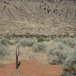
- Shortly up the trail from the junction, visitors will encounter the wilderness boundary sign where they should drop down to the wash bed to continue the hike.
-
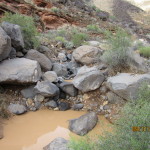
- The creek bed carries water during and after rains which can be a problem for visitors in the deeper parts of the canyon.
-
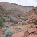
- The wash bottom consists of rocky substrate with lots of volcanic and sandstone boulders throughout much of its length.
-
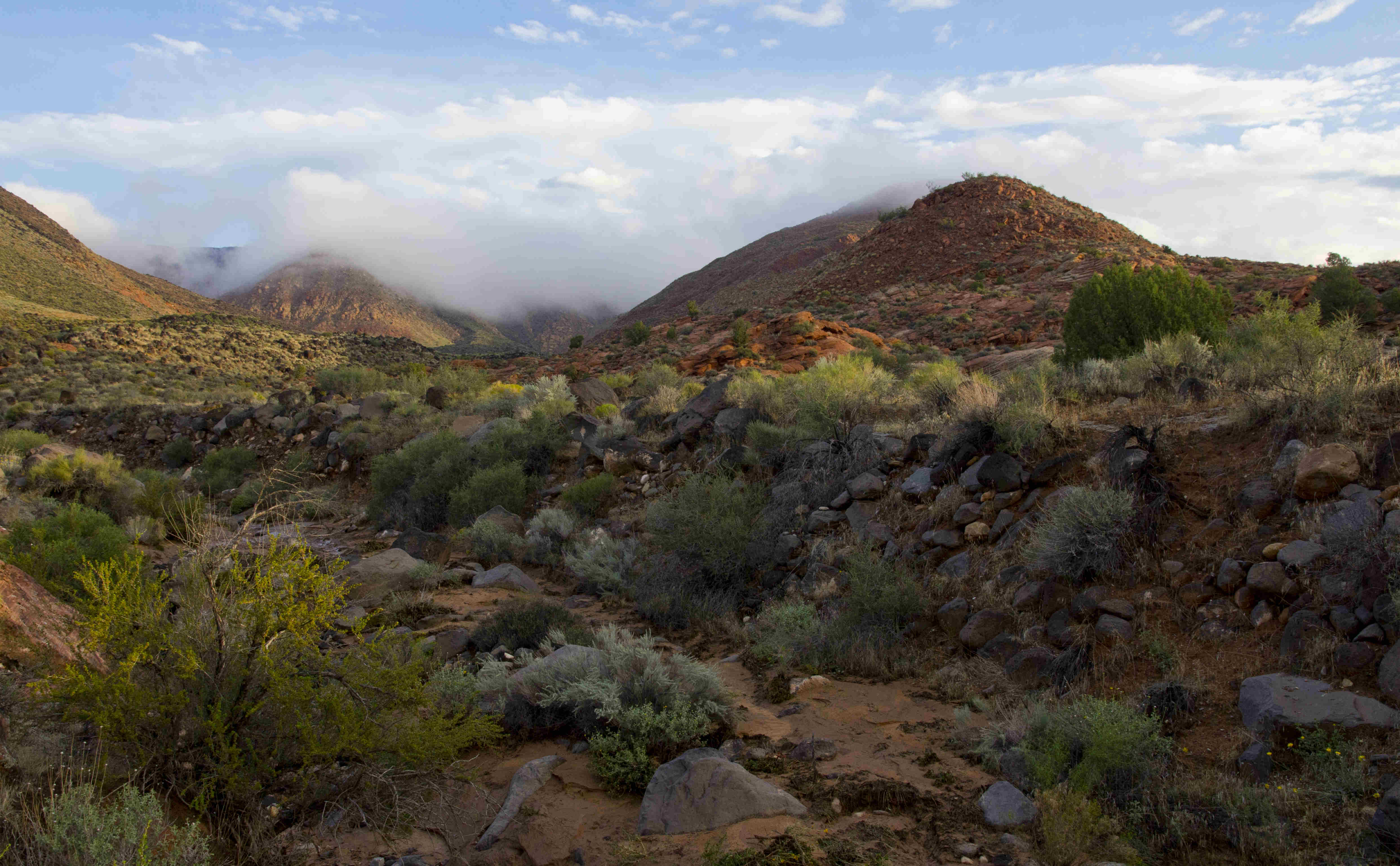
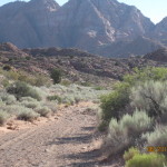
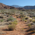
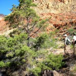
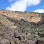
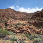
- Through much of the upper trail, the creek flows through an open canyon environment.
-
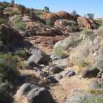
- Rock walls and dense vegetation frequently impede visitor progress through the wash.
-
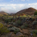
- Early morning hikes will frequently provide beautiful views of the sandstone environment mixed with desert vegetation.
-
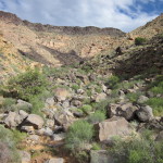
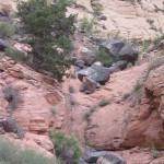
- Throughout the upper portion of the trail, volcanic boulders will usually find the low spots in the wash.
-
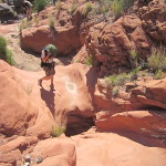
- Hikers will enjoy some rock scrambling on red rock portions of the trail.
-
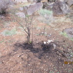
- In other portions of the upper canyon, visitors will observe evidence of a major range fire that occurred in 2012.
-
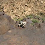
- Hikers will find potholes and other red rock formations to explore while hiking the canyon.
-
- Hikers will find some user trails above the wash to go around rock and vegetation blockages.
-
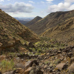
- Beautiful views to the south are had from the upper portions of the canyon.
-

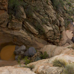
- This dry fall on the west fork can be full of water and is a show stopper for most hikers.
-
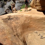
- Here hikers stand above the dry fall during the dry season. Most visitors will turn back at this point.
-
- Immediately above the dry fall, the black lava flow spills down from the top of the canyon.
-
- Capable hikers and rock scramblers may choose to ascend the black lava flow on a steep slope to reach the top of the canyon at this point.
-
- Adventurous climbers are treated to beautiful views of the upper plateau as seen along this section of the canyon.
-
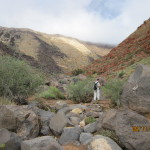
- For a different experience, visitors may choose to hike the east fork starting at this point in the middle canyon.
-
- The east fork runs approximately 3/4 mile through a red sandstone canyon with interesting formations and scenic views.
-
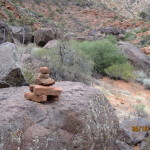
- Part way into the east fork, visitors are faced with a choice of drainages and should proceed directly north at this user cairn.
-
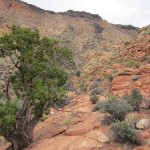
- The upper portion of the east fork displays a diversity of vegetation and rock formations with opportunities to explore in the wilderness environment.
-
- This ten foot dry fall will impede further travel on the east fork for most visitors.