Snow Canyon State Park (Fee Area)
Snow Canyon State Park is located in large part within the Red Cliffs Desert Reserve. Visitors wishing to use any of the trails within the Park’s fee area, (mostly those between the north and south entry stations,) will need to purchase a daily permit or have an annual park pass and to comply with special rules to protect the remarkable resources for which the Park was created. A copy of the Park’s brochure can be printed from the website link in the introduction to this section. Trails crossing lands administered by the Utah Division of Parks and Recreation outside of the fee area are listed along with all other trails in this subsection. The following information is provided for each of the fee area trails (distances are rounded and reflect one way travel):
Butterfly Trail: One mile. Moderate difficulty. Some steep slopes and uneven surfaces. Winds along the west side of Petrified Dunes and leads to the West Canyon Overlook and lava tubes.
Hidden Pinyon Trail: ¾ mile. Moderate difficulty. Some rocky slopes, some deep sand, some small drop-offs. This fun, self-guided nature trail highlights geologic features and native plants.
Jenny’s Canyon Trail: ¼ mile. Fun, easy walking. Level, dirt trail with a few slopes and steps. Great children’s trail leading to a short, slot canyon. Trail is closed from March 15 to June 1 to protect critical resources.
Lava Flow Trail: ½ mile to West Canyon Overlook from Lava Flow parking. Moderate difficulty. Uneven lava surfaces. Winds through a jumbled lava field with lava tubes found in two locations. Exercise great caution and be properly equipped with protective clothing and flashlights when visiting the tubes (not for toddlers).
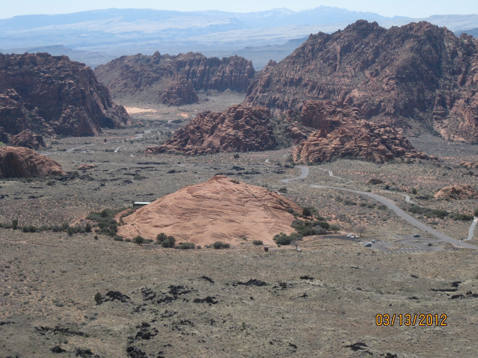
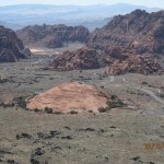
Petrified Dunes Trail: ½ mile from Petrified Dunes parking. Easy trail, moderate difficulty on open hiking on the Dunes. Some steep slopes, uneven surfaces. Trail crosses massive Navajo sandstone outcrops and sand dunes frozen in time. Great views of the canyon geologic features.
Pioneer Names: ¼ mile. Easy hiking. Fairly level with some steps and slopes. This crescent-shaped trail passes pioneer names written in axle-grease, dating back to 1881.
Three Ponds: 1 ¾ miles. Moderate difficulty. Some rocky slopes and lots of deep sand in the western half. Trail winds through red sandstone, then a sandy wash to the mouth of a 400-foot tall canyon.. Potholes eroded in sandstone catch seasonal rain, giving the trail its name.
Sand Dunes Trail: ¼ mile. Easy. Deep sand with some slopes. Trail leads to a large area of red sand serving as a giant sandbox and play area for families and children of all ages.
West Canyon Road: 4 miles. Easy. Gravel and sand surface. Fairly level. Follows a maintenance road to several pump stations, winding past numerous washes and below towering cliffs to the head of Snow Canyon. Great views. Very good for hiking, jogging, or biking.
Whiptail Trail: 3 miles. Easy. Level with some slopes. Accessible to people with disabilities. The paved trail winds through the canyon from the south entrance to near the Upper Galoot picnic area. Excellent for hiking, jogging, or biking.
Whiterocks Trail: 2 miles. Moderate difficulty. One steep climb in soft sand, some rocky slopes, uneven surfaces. Parking off SR-18 exists ½ mile north of upper entrance station. Main trail leads to connection with Lava Flow trail at the east lava tube. Alternate ½ mile route leads to a natural, white sandstone amphitheater. Fun and beautiful hike. Permit or pass is required.
-
- All visitors to Snow Canyon State Park pay an entrance fee to enter the designated park boundaries and to use the numerous trails and facilities.
-
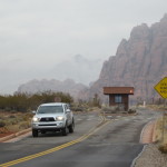
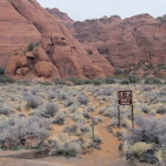
- Vehicle access is restricted to the Snow Canyon road, associated pull-outs, parking areas, and head-quarters. Direct access is provided to 9 trails and indirect access to 3 others in the fee area.
-
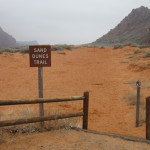
- Visitors to the sand dunes play area may park at the south picnic area and take this short trail to the dunes.
-
- The 6 mile Whiptail trail provides paved access to serve hikers, bikers, and disabled patrons.
-
- The West Canyon trail serves as a key maintenance road but provides excellent hiking and biking opportunities over a dirt and gravel surface.
-
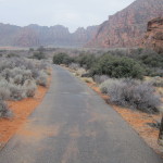
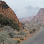
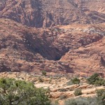
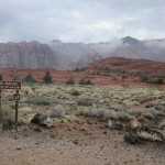
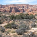
- Spectacular red sandstone cliffs rise above the entire length of the West Canyon trail and can be viewed from most locations in the Park.
-
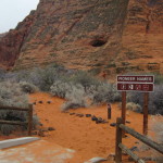
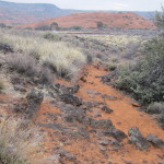
- Most trails in the fee area are on sandy substrates such as this trail to historic Pioneer Names.
-
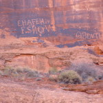
- Evidence of historic and pre-historic features may be found within the Park boundaries including this panel of historic pioneer names.
-
- Several trails take visitors to unique features and overlooks including the lava tubes, the Whiterocks Amphitheater and the mini-slot canyon which is at the end of the Jenny’s Canyon trail shown above.
-
- Hikers on the Hidden Pinyon trail will enjoy a variety of sub-environments and views of spectacular red sandstone cliffs.
-
- Visitors to the Petrified Sand Dunes trail will be able to hike over a wide swath of extraordinary sandstone formations comprised of ancient sand dunes.
-
- Several trails cross areas covered with black lava from ancient volcanic flows and provide some uneven footing that warrants special care by visitors, especially small children.
-
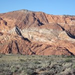
- Trails that go further away from most Park developments will often provide spectacular views of banded sandstone peaks and canyons and abundant desert vegetation.
-
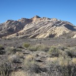
- Trails at the northern end of the Park will take visitors into beautiful white rock formations such as this one off the Whiterocks trail.