Skip to content
Red Cliffs Desert Reserve
  • About Us
    • Privacy Policy
  • In the Park
    • Trails & Trailhead Maps
    • Wildlife of the Reserve
    • Plants
    • Geology
    • Confluence Park
  • Plan Your Visit
    • Rules & Regulations
    • Our Visitor Center
    • Recreation Opportunities
    • Community Science
    • Links & Documents
    • Frequently Asked Questions
  • News & Events
    • Public Meetings
    • Calendar
  • Contact Us
    • Report Wildlife
    • Educational Programs
    • Survey Clearances
    • Volunteer
    • Court-Ordered Service
    • Employment Opportunities

Take Area Maps

A take area is a habitat zone outside of Red Cliffs Desert Reserve that is considered occupied by Mojave Desert tortoise. Any development or habitat disturbance within these tortoise take areas must be coordinated with the Reserve Administration prior to ground disturbance.

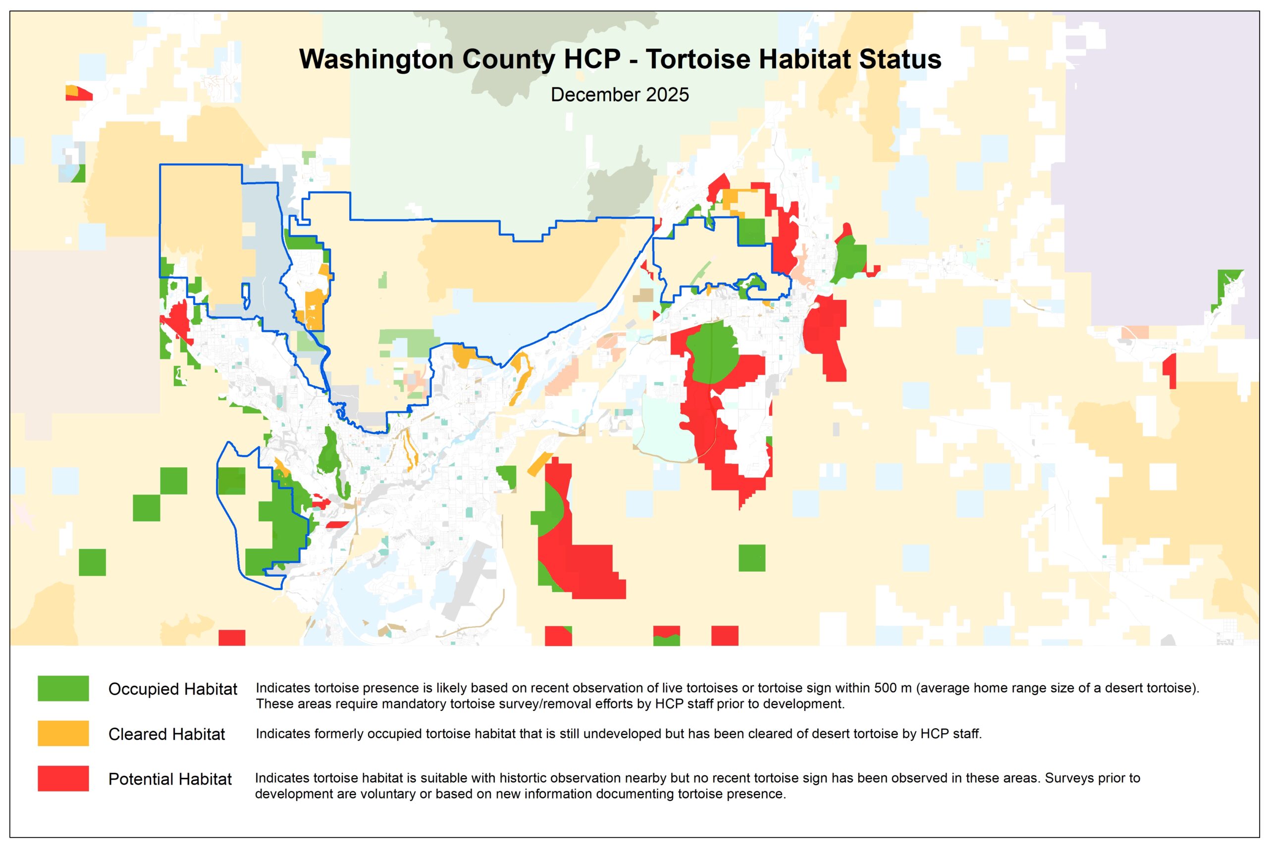
Maps of Occupied Tortoise Habitat:

  • All take areas in the County
  • St. George
  • Ivins & Santa Clara
  • Washington
  • Hurricane, Leeds & La Verkin
    • About Us
    • In the Park
    • Plan Your Visit
    • Links & Documents
    • News & Events
    • Contact Us
    • Facebook
    • Instagram
    • YouTube
    Washington County HCP Administration
    111 E Tabernacle St.
    St. George, UT 84770
    (435) 301-7430
    Send a Message
    © 2026 Red Cliffs Desert Reserve • Privacy Policy