Alger Hollow
This 2.1 mile trail is an easy, generally level route that historically has served as access for powerline maintenance and fire control. It is a wide single track for most of its length with a dirt substrate. The trail winds across the upper plateau between Diamond Valley and St. George, Utah and runs through desert shrub and juniper habitat. From the Lava Ridge trailhead stepover to the trail’s southern junction with the Lange’s Dugway trail, elevation loss is about 300 feet with a total up and down change of 380 feet. The junction with Lange’s Dugway entails a hike or ride of about 2½ miles from the start of the Lange’s Dugway trail out of the Black Gulch trailhead parking area. The trail is most often used by equestrians making a loop with Lange’s Dugway and other connecting trails. To get to the northern trailhead from Diamond Valley, visitors must find the access road which consists of a graded dirt road coming off W. Amethyst Drive. Those travelling in a vehicle can reach that point by taking W. Diamond Valley Drive east from Highway 18 to the junction with N. Sapphire Drive and following that south around the curve to the junction with Amethyst Drive. Turn right on Amethyst and proceed ¾ around the loop until you reach the unsigned graded road. Travel on the road should never be taken during or shortly after wet weather. The road becomes a sticky clay bog that stops people and vehicles in their tracks. Views from the trail include the beautiful Pine Valley Mountains to the north and parts of southern Washington County and the northern Arizona mountains to the south. All or parts of the Alger Hollow trail can be overgrown with cheat grass and weedy shrubs during the latter 2/3 of wet years due to lack of constant year-round use. The entire trail crosses lands administered by the Bureau of Land Management within the Red Cliffs NCA.
-
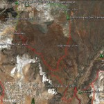
- This map shows the Alger Hollow trail and all its linkages to other trails in the area.
-
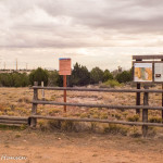
- Visitors may access the trail from the north 1.2 miles out of Diamond Valley to reach the Diamond Valley East trailhead. Visitors should not use this access during or after rains.
-
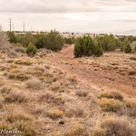
- Visitors will travel across a jeep maintenance road coming out of the trailhead heading south.
-
- The trail drops down into a hollow supporting a community of juniper trees.
-
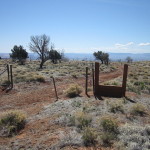
- The trail runs along a two-track through this gate with a stepover at the south boundary of a livestock grazing allotment.
-
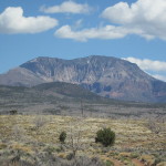
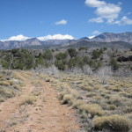
- Through much of the trail visitors will have excellent views of the beautiful Pine Valley Mountain located to the north.
-
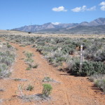
- The trail continues to the south along a two-track which serves as a powerline maintenance and emergency vehicle road.
-
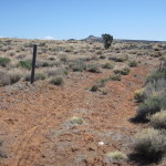
- The trail ends on the south at this junction with the Lange’s Dugway trail. Visitors may also begin their hike or ride at this point and proceed to the north.